About the Parish
St Breward is a Cornish Parish high up on the western edge of Bodmin Moor with some of the highest ground in Cornwall. Roughtor (1312ft, 400m) and Brown Willy (1,378ft, 420m), the two highest peaks, form the eastern edge of the parish and the western edge slopes down off the moor to the banks of the River Camel. Most of its 9,430 acres (3,817 hectares) is unenclosed moorland providing rough grazing, amongst the furze, heather and bracken for sheep, ponies and cattle. Trees and small, isolated, ancient farms exist in the less exposed areas. The De Lank River, a tributary of the river Camel, rises and passes through the parish.
The main settlement of the parish, St Breward village descends in a line from the exposed Parish Church of St Branwalader, recorded in the 12th century as Sancti Brewveredi de Hamatethi, down the hill to Limehead, a distance of just over one mile. Today with about 208 dwellings, the village was until World War 2, a series of small hamlets at Churchtown, Rylands, Lower Penquite, Row, Higher Penquite and Limehead, nestling between areas of common land. It is midway between Camelford and Bodmin (6miles approx) and 10 miles from Wadebridge, the three nearest towns which provide those services not found in the village. The parish also contains the smaller settlements of Delank (Lower Lank), Hantergantick, Penpont, Penrose, Penvorder and Tuckingmill.
Central to the life of the village are the primary school, Parish Church, village shop, pub and football club. The village has fthree community rooms, the Village Hall at Churchtown, the Band Room and the Institute & Memorial Hall lower down at Limbhead. Other important services are a doctors’ surgery, and a monthly mobile library.. There is a play areas at Rylands and our Community Bus is regularly used. The village has a Silver Band and a Guide & Brownie group which meet in their hut at Lower Lank.
Landscape designations cover the entire Parish, including an Area of Outstanding Natural Beauty, an Area of Great Landscape Value, a Site of Special Scientific Interest, a Special Area of Conservation, several Cornwall Nature Conservation Sites, and an Area of Great Historic Value.
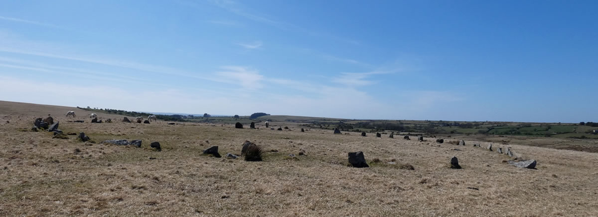
Everywhere there are signs of human activity from prehistoric features such as burial chambers, stone circles, settlements and field systems to medieval farmsteads, chapels, wells, crosses and streamworks, and most recently to post-medieval quarrying, china clay working and mining.
Moorland Granite has been used for centuries to build local houses and churches and stone from St Breward quarries was used for important and famous landmarks including the Eddystone Lighthouse 1882, the Beachy Head Lighthouse 1900 and Tower Bridge 1890 and London Bridge 1991.
The parish also contains some of Bodmin Moor’s most spectacular scenery and is the starting point of the renowned Camel Trail at Wenfordbridge, 18 miles of disused railway track bed beside the River Camel, converted to a cycle trail, linking the towns of Bodmin, Wadebridge and Padstow. It is Cornwall’s busiest tourist and local attraction with some 400,000 visitors each year.
The parish is also important for its rare flora and fauna, including insectivorous sundew, common cotton grass and cross-leaved heath. There are also a number of rare ferns and mosses. It has significant breeding populations of wheatear and meadow pipits and small colonies of the Pearl-bordered fritillary butterfly.
Clay working, granite quarrying and farming used to be the parish’s main sources of income and jobs. Clay working has ceased; only one of three granite quarries remain with few local jobs and modern farmers rely mainly on family and machinery. Tourism and public services provide the bulk of the jobs in the parish today.
Taken from the St. Breward Parish plan 2010